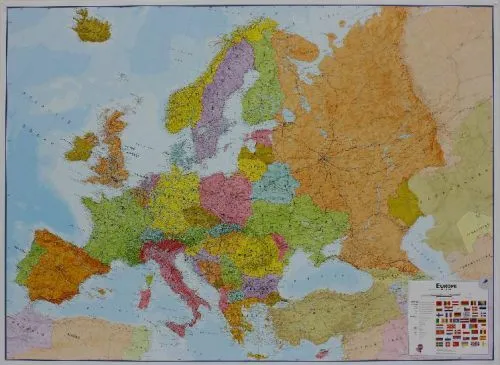
Europe - Europa political wall map laminated
0.0
( 0 )
Engelsk
Laminated flat map of Europe in the scale 1:4.3 mill. Size: Width 165 cm x hight 120 cm.
Our politically coloured wall map of Europe features countries marked in different colours, with international ...
På lager i 0 butikker.
Forlagsbeskrivelse af Europe - Europa political wall map laminated af Maps International
Laminated flat map of Europe in the scale 1:4.3 mill. Size: Width 165 cm x hight 120 cm.
Our politically coloured wall map of Europe features countries marked in different colours, with international boundaries shown. All major towns and cities of Europe are featured within our map, and the countries capital cities are clearly marked. The map contains hill and sea shading adding to the vibrant overall effect. The wall map also contains a section showing the different flags of countries in Europe.
This Large Europe Wall Map Political (Laminated) with encapsulation gives the map a write on / wipe off finish. Using a dry wipe marker, any writing on the map can be wiped off with a proprietary cleaner.
Detaljer
Forlag
Maps International
Udgave
0
ISBN
9781903030660
Sprog
Engelsk
Originalsprog
Sproget kan ikke bestemmes
Udgivelsesdato
01-03-2019
Varenr.
2665446
EAN nr.
9781903030660
Varegruppe
Maps/guides
Bogens kategorier Klik på en kategori for at se lignende bøger
Anmeldelser Europe - Europa political wall map laminated
Brugernes anmeldelser
Andre har også kigget på
Som medlem af Klubben sparer du 50% fragten og optjener point, når du handler | Medlemskab til 0 kr. uden binding og gebyrer.
Ofte købt sammen med
Som medlem af Klubben sparer du 50% fragten og optjener point, når du handler | Medlemskab til 0 kr. uden binding og gebyrer.
